Geography & Landscape
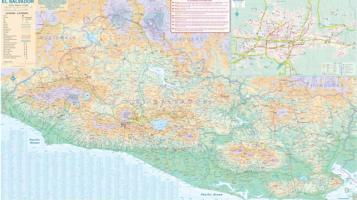
Map of El Salvador
Ironically, it is difficult to find a good map of El Salvador for sale in El Salvador. Currently, we think this is the best map of El Salvador. You can get it HERE on Amazon. The back side includes neighboring Guatamala, so it’s two for the price of one. It’s a weather-proof map. This particular map, at this time, is the only map with a color inset of San Salvador, the capital and largest city in El Salvador. You will get this map for free during an El Salvador Relocation Tour.
Map of San Salvador
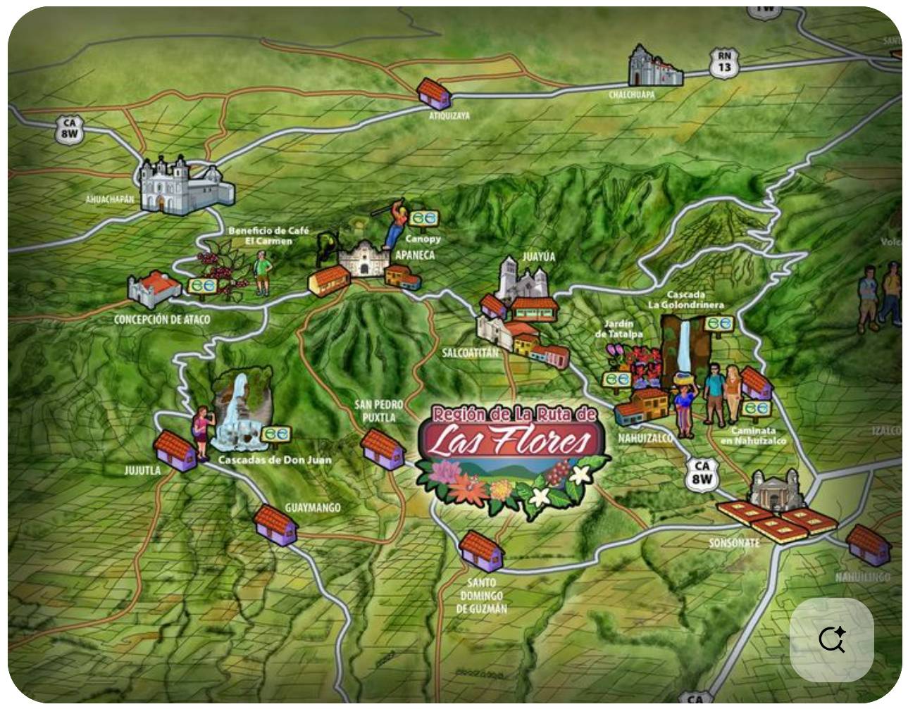
Ruta de las Flores
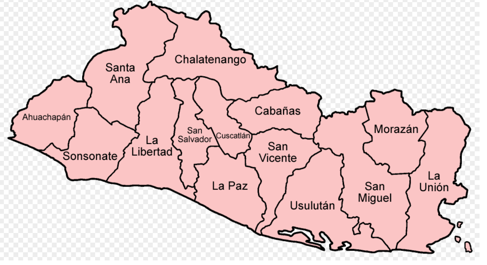
The 14 Departments of El Salvador - Think of these as states or provinces.
El Salvador is divided into 14 departments (departamentos).
Here is the complete, official list with their capitals (as of 2025):
| # | Department (Departamento) | Capital (Cabecera) | Region |
|---|---|---|---|
| 1 | Ahuachapán | Ahuachapán | Western |
| 2 | Santa Ana | Santa Ana | Western |
| 3 | Sonsonate | Sonsonate | Western |
| 4 | La Libertad | Santa Tecla (Nueva San Salvador) | Central |
| 5 | Chalatenango | Chalatenango | Northern |
| 6 | San Salvador | San Salvador | Central |
| 7 | Cuscatlán | Cojutepeque | Central |
| 8 | La Paz | Zacatecoluca | Central |
| 9 | Cabañas | Sensuntepeque | Northern |
| 10 | San Vicente | San Vicente | Central |
| 11 | Usulután | Usulután | Eastern |
| 12 | San Miguel | San Miguel | Eastern |
| 13 | Morazán | San Francisco Gotera | Eastern |
| 14 | La Unión | La Unión | Eastern |
Quick regional grouping most people use
- Western (coffee & Ruta de las Flores area): Ahuachapán, Santa Ana, Sonsonate
- Central (most populated): San Salvador, La Libertad, La Paz, Cuscatlán, San Vicente, Chalatenango, Cabañas
- Eastern (volcanoes, beaches, less populated): San Miguel, Usulután, Morazán, La Unión
If you’re moving for remote work, the departments you’ll probably deal with most are San Salvador (the capital metro area) and La Libertad (Surf City / beach towns where many digital nomads live).
El Salvador International Airport - SAL
El Salvador’s primary international gateway is the Monseñor Óscar Arnulfo Romero International Airport (SAL), commonly known as El Salvador International Airport. Located southeast of San Salvador’s city center.serves as the country’s sole major commercial airport and a key hub for regional and international travel.